Progress of the International Data Validation for GlobeLand30
Zheng, X. Y.1* Chen, J.1 Liu, C.2 Wang, Z. X.2 Shi, R. X.2 Zhang, H. W.1 Chen, L. J.1 Tong, X. H.3 Xie, H.3 Han, G.1 Wei, C.3
1. National Geomatics Center of China, Beijing 100830, China;
2. Institute of Geographic Sciences and Natural Resources Research, Chinese Academy of Sciences, Beijing 100101, China;
3. Tongji University, Shanghai 200092, China
In summarizing the progress in international validation of global land cover datasets under the framework of Group of Earth Observations (GEO), and promote the international, application and validation of GlobeLand30 dataset, the National Geomatics Center of China (NGCC) cooperated with Institute of Geographic Sciences and Natural Resources Research, Chinese Academy of Sciences (IGSNRR/CAS), Tongji University, Wuhan University and Geo-Compass Geoinformation Technology Company, organized an International Workshop on Global Land Cover Data Validation. The representatives from 10 countries (i.e., U.S.A, Canada, Greece, Bulgaria, Mexico, Kenya, etc.) reviewed the progress report on international validation of 30 m global land cover products under the framework of GEO, checked the validation results from sample countries and regions.
With the support of the National High Technology Research and Development Program of China (863 Program) “Remote Sensing Mapping and Research on Key Technologies of Global Land Cover” (project No. 2009AA122000), NGCC had led the research on global 30 m resolution land cover product?DGlobeLand30, which is openly available for all. In order to promote the broader application and refinement, ever since December 2015, under the framework of GEO, 25 GEOM members and 15 non-GEO international organizations (i.e., UN-GGIM and CODATA, etc.) were recommended to join the international data validation activities. The experts agree the following progress of the data validation activities.
1 Technical Specification of Global Land Cover Data Validation
Based on over 10 teleconferences between the international teams of global land cover data validation and the Secretariat of GEO, two international seminars, and the exchanged advises from Deutsches Zentrum für Luft- und Raumfahrt (DLR), International Institute for Applied Systems Analysis (IIASA), and KTH Royal Institute of Technology, etc., the technical specification for validation had been brought up to the international seminar. The participating experts agreed that the validation method of the Landscape Shape Index (LSI) used in the data validation of 30 m global land cover is an novel method, especially during the process of the data sampling, labeling and accuracy assessment reporting, which worth outreaching due to its sound science, practicality and network interoperability.
2 Global Online Co-verification Validation System (GLCVal V1.0)
The seminar had summarized the progress in the validation based on Global Online Co-verification System (GLCVal V1.0). The experts had agreed that it would be very hard to coordinate the global data validation without such internet-based global co-verification system. The development and the trial run of GLCVal V1.0, especially in the functionality of the sample computing, sample allocation, sample judgment, accuracy assessment, etc., had provided a convenient, reliable platform for different countries and regions in the world.
3 International Seminars and Training Workshops of Global Land Cover Data Validation
To ensure the consistency of global data validation, the project team had organized three international seminars (June 2015 and July 2016 in Shanghai; September 2016 in Beijing), two technical training workshops (June 2015 in Beijing and April 2016 in Ethiopia) which were co-organized by the United Nations Committee of Experts on Global Geospatial Information Management (UN-GGIM) and National Administration of Surveying, Mapping and Geoinformation (NASG). The training workshops had trained several technical backbones in the developing countries who were participants of the global land cover data validation team.
4 Validation of GlobeLand30 at National and Regional Levels
The validation work began at the national and regional level. Until now, over 20 countries and regions have finished validation work, including: Greece, Sweden, Kenya, Tanzania, South Africa, Canada, etc. These validations were conducted by respective representatives of their country, which has provided a detailed basis for the conclusion of global validation.
5 The Preliminary Results of the Data Validation of GlobeLand30-2010
The samples of the global validation of GlobeLand30-2010 totals 202,997, extracted based on three methods: two-stage stratified sampling, LSI sampling, and big data based sampling. With the two-stage stratified sampling method, 154,070 samples were extracted, the overall accuracy (OA) of GlobeLand30 is 83.50%±0.19%, and the Kappa is 0.78; With LSI method, 6,714 from 19 countries are extracted, and the overall weighted accuracy (OWA) is 75.83%; With big data?Dbased method, 37,140 samples are extracted and OA is 65.88%. In summary, by calculating the weight of the total samples of these three sampling methods, OWA is 80.03%.
Participants agreed on the further cooperation for validation, including the Technical Specifications of the Global Land Cover Data Validation, GEO report and the book on global land cover data validation.
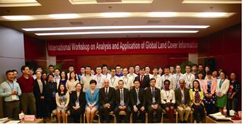
Figure 1 The group photo of the international workshop on Analysis and Application of Global Land Cover Information (September 2016, Beijing)